A 15ft Pram for Dinghy Cruising
20180625
20180626
20180627
20180628
20180629
20180902
20180915
20181014
20190208
20190422
20190510
20190511
20190512
20190525
20190601
20190803
20190804
20190805
20190807
20190811
20190819
20190820
20190821
20190822
20190823
20190828
20190908
20190922
20200216
20200603
20200612
20200712
20200718
20200719
20200727
20200822
20200905
20200910
20200911
20200912
20200913
20200920
20210305
20210509
20210724
20210905
20210912
20211003
20220430
20220508
20220603
20220618
20220821
20220828
20220904
20220911
20221009
20230423
20230520
20230528
20230625
20230805
20230806
20230810
20230903
20230906
20230910
20230911
20231001
20231008
20240423
20240515
20240603
20240614
20240623
20240710
20240714
20240716
20240720
20240723
20240725
20240726
20240727
20240730
20240908
20240915
20240929
20241007
20241019
20241021
20241110
20250420
20250421
20250422
20250428
20250504
20250505
20250622
20250630
20250707
20250716
20250717
20250718
20250719
20250720
20250721
20250724
20250725
20250825
20250907
20250910
20251019
<<
>>
20190803 |
|
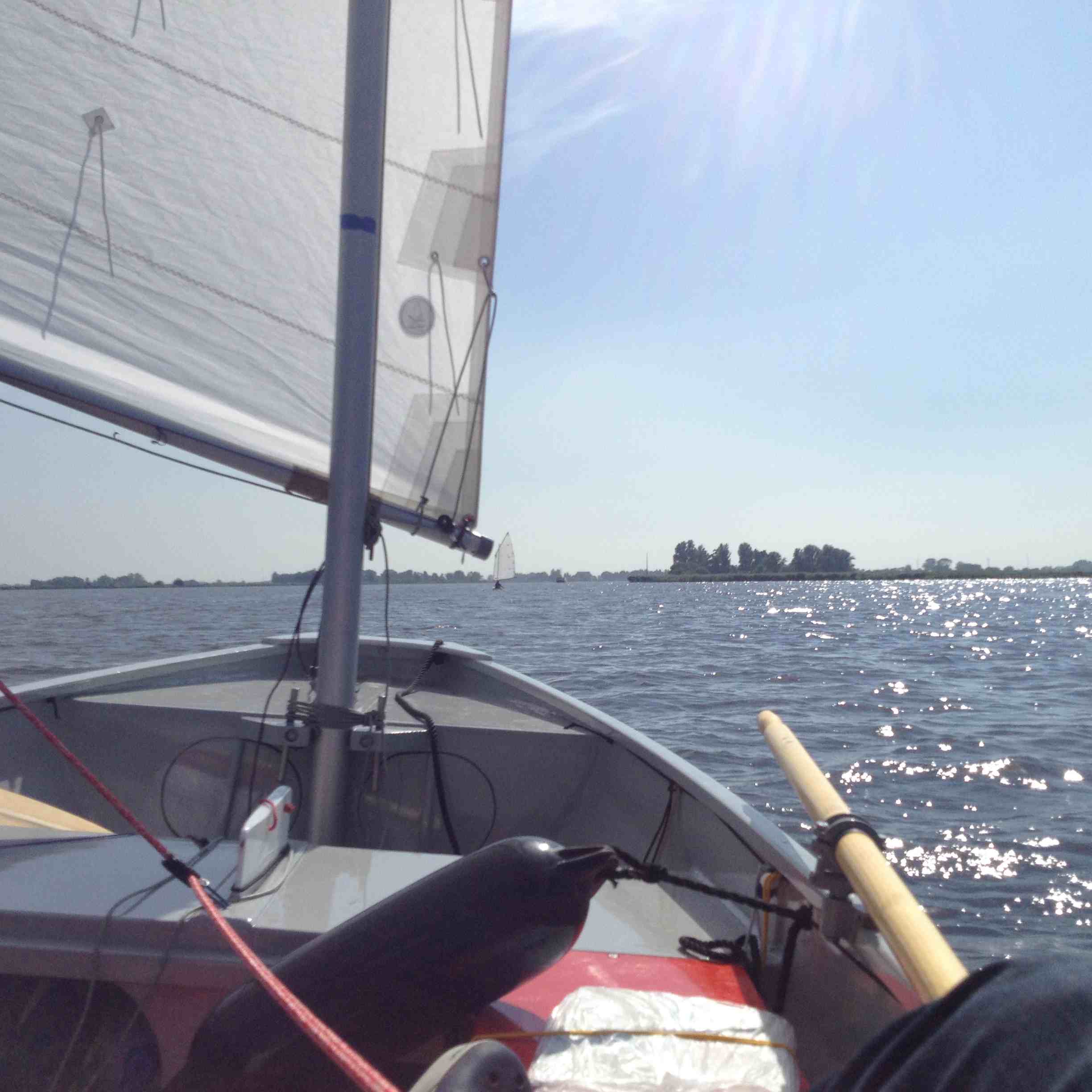
Published in Dinghy Cruising Journal 243 Our Trip to the Schlei 1This year Klarie and I wanted to take Hatseflats on a trip to explore new sailing venues in Northern Germany and Denmark.We were inspired by Sam Griffiths' report in DCJ 238 to visit the North Frisian islands.We planned to go to the Schlei fjord, sail on the Lille Baelt in Denmark, visit the North Frisian islands, and finally join the Noorderraid which would be held on the Lauwersmeer in the North of Holland in early August.The idea was to launch Hatseflats near Schleswig in the west and sail to Schleimunde, overnighting at waterside campings. We set off on Friday morning. Before we got to Bremen the traffic was already quite busy. South of Hamburg the traffic got much worse and we lost a few hours driving slowly through the many roadworks.We made a detour to the camping at Schlei-Karschau just west of Arnis (the smallest town of Germany). The camp site was friendly and very clean with a little harbour for camping guests. On Saturday we launched Hatseflats from a public slip across the road. As we sailed off there was a string of yachts heading west to Landaunis. We crossed the Schlei and anchored to have lunch. We hoisted sail again and headed to Arnis with a W2. Most of it was running and reaching. On our trips on the Schlei we navigated using the Jubermann TA1 atlas. These 1:25000 maps provide much information including camp sites, youth hostels etc. Accommodations are listed at the back complete with web sites and contact information. We passed Arnis with its boatyards, chain ferry, waterside cafes and many boats moored alongside the Schlei. After Arnis we continued to Kappeln. The wind dropped and we turned around before the bridge at Kappeln to get back at the camp site before dark. We enjoyed the landscape with farms and fields on the rolling hills, and houses and trees on the green banks. Back at Arnis I started rowing to keep out of the way of the chain ferry. As we approached Karschau we passed a couple of yachts anchored for the night. We returned at 1830 hours. Total distance 11nm 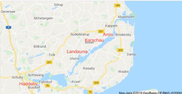 The Schlei Fjord |